The Autoroute 73 ( officially called the Autoroute Laurentienne through the Quebec City urban area, but known locally as “Henri-IV” northbound (toward the Laurentians, named for the boulevard of the same name that it follows into the city) and “Robert-Cliche” southbound (toward the Beauce, named for the Beauce politician and judge) ) is Quebec City’s primary north-south highway corridor — which autoroute is which trips up most newcomers — and the infrastructure that most directly connects the capital to the two major recreational and economic regions on its axes: the Laurentian wilderness and ski resorts to the north, and the entrepreneurial Beauce and the American border to the south. The highway’s routing through the urban core ( cutting through several arrondissements’ residential and commercial fabric ) has created the familiar Canadian highway-in-city-fabric planning challenge that Quebec City’s urban planners have been managing since the highway’s construction in the 1960s-1970s.
North: Henri-IV to the Laurentians
Northbound from the Autoroute 40/73 interchange in the western urban core, the Autoroute 73 (Henri-IV northbound) passes through the La Haute-Saint-Charles arrondissement’s residential fabric and exits the urban area at the northern city boundary, continuing through the Réserve faunique des Laurentides to the Stoneham ski resort (30 minutes), the Parc national de la Jacques-Cartier entrance (40 minutes), and the beginning of the Saguenay-Lac-Saint-Jean region (approximately 2 hours). The highway’s role as the primary access to Quebec City’s winter recreation infrastructure (Stoneham, the northern snowmobile trail network, and the wilderness of the Laurentides reserve) makes it the most heavily used recreational highway corridor in the metropolitan area during the ski and snowmobile season.
South: Robert-Cliche to the Beauce & US Border
Southbound from the Quebec City urban area, the Autoroute 73 (Robert-Cliche southbound) crosses the St. Lawrence River via the Pont Pierre-Laporte and continues through the Lévis area toward the Beauce ( the entrepreneurial region of the Chaudière River valley. The highway terminates at the US border at Armstrong (approximately 120 km south of Quebec City), providing the primary ground transportation connection between Quebec City and the northeastern United States via Maine and the I-95 corridor. The Robert-Cliche designation ) honouring Robert Cliche (1921-1978), the Beauce-born lawyer, NDP leader in Quebec, and judge who was one of the most respected public figures of his generation acknowledges the highway’s role as the primary connection between Quebec City and the Beauce cultural heartland.
The Urban Impact
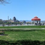
The Autoroute 73’s routing through the Quebec City urban fabric ( the elevated sections visible from the inner-city quartiers, the interchanges that have created barriers between neighbourhoods, and the noise and air quality impacts of sustained highway traffic in urban contexts ) has been the subject of urban planning debate since the highway’s construction era. The section through the Sainte-Foy–Sillery zone (where the highway passes adjacent to the Promenade Samuel-de-Champlain’s waterfront park) is the most visually intrusive: the elevated highway structure visible from the Promenade is the most significant visual detractor in what is otherwise Quebec City’s finest public waterfront space. The highway’s eventual transformation (through tunnel placement or elevated removal programs of the type undertaken in other North American cities) remains a long-term urban planning aspiration without near-term funding commitment.