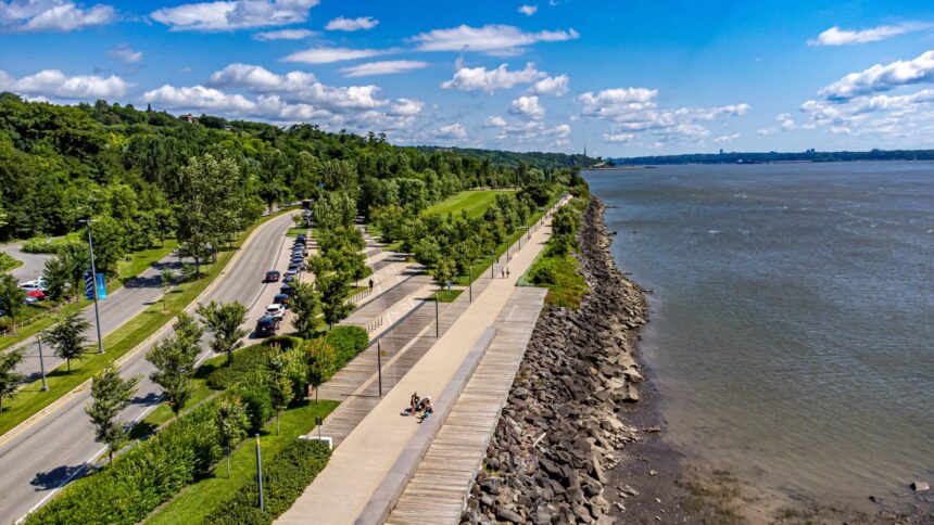
The Promenade Samuel-de-Champlain ( the waterfront linear park along the St. Lawrence shore in the Sainte-Foy–Sillery–Cap-Rouge arrondissement, created in phases between 2008 and 2017 ) is the most transformative public space investment in Quebec City’s history and the physical expression of the city’s reclamation of its St. Lawrence waterfront after a century of industrial and highway infrastructure that had separated the residential and commercial city from the river. The three-phase development (Phase 1: 2008, 2.5 km from the base of the Cap Diamant cliff to the Sillery shore; Phase 2: 2013, extending east toward the Old City; Phase 3: 2017, extending west to Cap-Rouge Bay) created the continuous 8-kilometre waterfront park that is now the most-used outdoor recreation space in Quebec City by total visitor days annually.
Phase 3: Cap-Rouge Bay
The Phase 3 extension (2017) ( which completed the Promenade westward to the Cap-Rouge Bay, where the Rivière Cap-Rouge enters the St. Lawrence ) added the most visually varied section of the Promenade: the Cap-Rouge Bay itself (a protected cove with sandy beaches, swimming in summer, and the remnants of the Cartier-Roberval colony site of 1541-1543 accessible through interpretation panels), the cliff face section where the trail descends from the plateau level to the waterfront, and the industrial heritage section near the former quarry operations that provided the limestone for many of Quebec City’s historic buildings. The Phase 3 section is less heavily used than the central phases (its greater distance from the urban core reduces casual visitor access), but it provides the most wilderness-feeling section of the Promenade the river visible without the bridge or marina infrastructure of the central section, the forested cliff face above, and the industrial archaeology of the former quarry operations visible in the eroded cliff faces.
Cycling the Full 8 km
A cycling trip along the full 8-kilometre Promenade ( from the Old Port connection at the Anse au Foulon to the Cap-Rouge Bay terminus ) takes approximately 45-60 minutes at a comfortable pace and provides the fullest survey of the waterfront park’s diverse sections. The recommended direction: westward (with the wind more often at the cyclist’s back and the river to the left for most of the route), beginning at the Anse au Foulon access point accessible by cycling from the Old City via the Corridor du Littoral’s eastern section. The Promenade’s cycling surface (mixed asphalt and packed gravel, all-weather) accommodates all bicycle types; the grade is flat throughout with the exception of the short cliff descent in the Phase 3 section. The Belvédère (the elevated platform at the Phase 1/2 junction, providing the finest single viewpoint of the St. Lawrence and the Lévis shore visible from the Promenade) is the essential photo stop.
Four Seasons on the Promenade
The Promenade’s year-round programming: summer (the beach at Cap-Rouge Bay, the kayak and paddleboard rentals at the Parc nautique, the weekly outdoor cinema at the Belvédère, and the social density of Quebec City’s outdoor season at full intensity); autumn (the most beautiful season for cycling ( the Sillery cliff’s forest in colour above, the October light on the river, and the dramatically reduced visitor volume creating an almost private waterfront experience); winter (the Promenade is maintained for cycling and walking through the winter season ) the river’s ice formation visible at close range, the silence of the waterfront in February broken only by the ferry passing and the wind off the river, one of Quebec City’s most atmospheric winter walks); spring (the ice breakup, the first returning shorebirds, and the sense of seasonal renewal that the river’s transformation from ice-covered to open water produces in early April).