The St. Lawrence River at Quebec City ( the point where the river narrows to approximately 1 kilometre between the Cap Diamant cliff and the Lévis shore, from which the city takes its Algonquian name (kebec, “where the river narrows”) ) is one of the most hydrologically complex urban waterways in the world: a tidal freshwater estuary with a tidal range of roughly 3.5 to 4.5 metres (among the largest anywhere on the St. Lawrence), a powerful bidirectional tidal current that reverses approximately every 6 hours, a winter ice regime that historically permitted walking across the frozen river for 6-8 weeks per year, and the spring ice breakup that is one of the most dramatic natural phenomena accessible from a major Canadian city. Understanding the St. Lawrence’s hydrology at Quebec City provides the context for understanding the city’s physical relationship with the river that has defined its existence since before European contact.
Is the St. Lawrence tidal at Québec City?
Yes. The St. Lawrence is genuinely tidal at Québec City — twice a day, every day. Fisheries and Oceans Canada operates a permanent tide station in the Old Port, Vieux-Québec (station 03248), at 46.8111° N, 71.2018° W. Its published predictions put high water at roughly 4 metres and low water at roughly 0.5 metres on an ordinary day — a range of about 3.5 to 4.5 metres, with spring tides at the new and full moon running higher. A second station, Pont de Québec (03265), covers the reach upstream.
The water here is fresh, not salt. Québec City sits in the tidal freshwater section of the estuary: the Atlantic tide propagates hundreds of kilometres upstream as a rise and fall in level and a reversal of current, while the salt front stays well downriver. Fisheries and Oceans Canada maintains a chain of gauges along the reach between Québec City and Montréal for exactly this reason — the tide is still measurable far above the city.
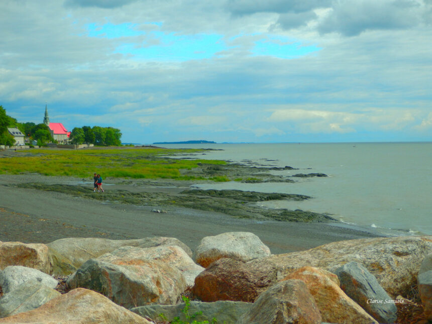
What that means in practice: the shoreline below the Promenade Samuel-De Champlain and at the Baie de Beauport changes substantially between tides, the current in the navigation channel reverses roughly every six hours, and the exposed intertidal flats at low water are working habitat for migratory shorebirds rather than permanent riverbank.
Source: Canadian Hydrographic Service tide station Vieux-Québec (03248), Fisheries and Oceans Canada. Predictions consulted 19 August 2026.
The Tides
The tidal range at Quebec City ( approximately 3.5 to 4.5 metres on ordinary days, more at spring tides (spring tides at the full and new moon reaching the maximum range, neap tides at the quarter moons reaching the minimum) ) is larger than at any inland point on the St. Lawrence and reflects the funnel geometry of the estuary that amplifies the Atlantic Ocean’s tidal signal as it propagates upstream. The tidal effect at Quebec City means that the river’s surface level changes by several metres between low tide and high tide, twice daily; the exposed intertidal zone (the rocky and muddy shore revealed at low tide) below the Promenade Samuel-de-Champlain and the Baie de Beauport provides critical habitat for shorebirds and the migratory species that use the estuary as a staging area. The tidal current ( running at 3-5 knots in the navigation channel at peak flow ) is the primary challenge for vessels navigating the Quebec City reach and explains the historical importance of pilotage (the Quebec City pilot service is one of the oldest in North America, established in the French regime to guide ships through the complex tidal waters).
The Ice Bridge
The pont de glace (ice bridge) ( the seasonal freezing of the St. Lawrence River at Quebec City sufficient to allow crossing on foot or by horse-drawn sleigh ) was a fundamental element of winter life in Quebec City from the colonial period through the early 20th century. Before the bridge’s opening in 1918, the ice bridge was the primary winter connection between Quebec City and the Lévis shore, operating from approximately late January through late March in a typical winter; its formation was monitored anxiously by merchants, farmers, and travellers, and its opening was a municipal event that the newspapers covered as major news. The ice bridge’s hazards (weak ice over tidal channels, the spring breakup that could strand travellers mid-river) produced the regular tragedies that generated the bodies of folk narrative preserved in the oral tradition. Climate change has made the ice bridge increasingly unreliable — it has not formed consistently enough for crossing in many recent winters, though shore ice still forms annually at the river’s margins.
Spring Breakup
The spring ice breakup (débâcle) ( the progressive disintegration of the river’s winter ice cover as rising temperatures and snowmelt flood flows fracture and mobilise the ice mass ) is one of the most dramatic natural phenomena visible from Quebec City’s public spaces. The breakup typically begins in late March or early April, when the river’s ice cover (which may be 60-90 cm thick at mid-winter) first develops cracks and open leads that the tidal current widens; within days, the ice cover breaks into the massive pans (glaces) that the tidal current and river flow carry downstream. The Dufferin Terrace provides the finest viewing platform for the débâcle: the succession of ice pans drifting through the Quebec City reach, sometimes piling against the Lévis shore and the bridge piers in spectacular pressure ridge formations, is visible from the Terrace’s cliff-edge position with a panoramic completeness unavailable from lower vantage points.