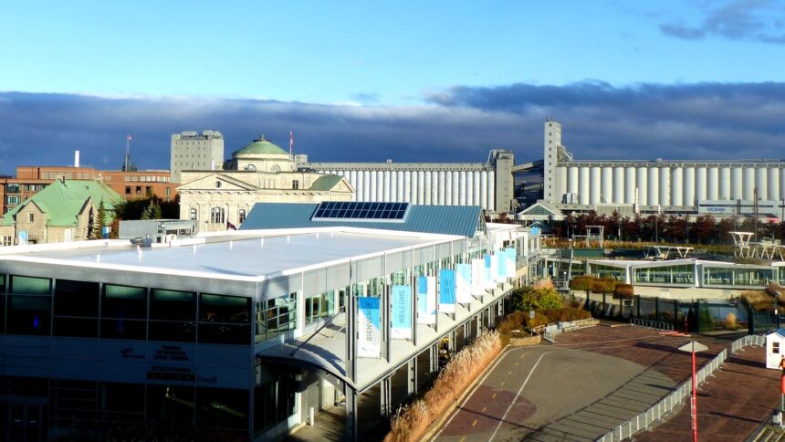
Cap-Blanc ( the narrow strip of urban territory wedged between the sheer face of the Cap Diamant cliff and the St. Lawrence River, running west from the Old Port along the Boulevard Champlain (Route 136) toward the Sillery shore ) is Quebec City’s most dramatically situated residential area and one of its most historically significant. The zone’s extreme compression (in some sections, the usable land between the cliff base and the water’s edge is less than 100 metres wide) has both limited its development and preserved its character: Cap-Blanc is a neighbourhood where the topographic constraint has produced an urban fragment of concentrated historical interest that the wider city’s expansion has left largely undisturbed.
Industrial Heritage
Cap-Blanc’s industrial heritage ( the former wharves, warehouses, and industrial facilities that occupied the narrow shore between the cliff and the river throughout the 19th and early 20th centuries ) is the primary archaeological layer beneath the contemporary Boulevard Champlain corridor. The timber trade’s crib wharves (the massive log-and-rock structures that extended into the river to accommodate the square-rigged timber ships), the industrial facilities that processed the forest products moving through the port, and the rail corridor that served the shore operations have all left physical traces in the zone’s archaeological record and occasionally in visible surface features. The Lieu historique national du Grosse-Île interpretation program (for the immigration port context) and the Cap-Blanc archaeological investigations that have accompanied construction work along the boulevard provide documentary access to this industrial heritage.
The Escalier du Cap-Blanc
The Escalier du Cap-Blanc ( the covered wooden staircase ascending the cliff face from the Cap-Blanc neighbourhood to the Battlefields Park plateau above ) is one of Quebec City’s most utilitarian and most characterful vertical connectors: a practical working staircase (used daily by residents of the Cap-Blanc neighbourhood accessing the Upper Town’s services and workplaces) that is simultaneously one of the most dramatic pedestrian experiences in the city. The staircase’s 275 steps (the exact count varies with reconstruction phases) ascend approximately 50 metres through the cliff face in a covered wooden structure that protects users from the elements; the view from the staircase’s upper landing ( looking south over the Cap-Blanc neighbourhood, the Boulevard Champlain corridor, and the St. Lawrence River ) is among the finest in the city for those willing to earn it by climbing rather than taking the funicular.
Contemporary Cap-Blanc
Contemporary Cap-Blanc is primarily a transitional zone rather than an active residential neighbourhood in the conventional sense ( the extreme physical constraints of the site limit residential development, and the Boulevard Champlain’s heavy vehicle traffic and the rail corridor create environmental conditions (noise, air quality) that make sustained residential occupation difficult. The zone’s most active contemporary use is as a cycling and walking corridor (the Corridor du Littoral passes through Cap-Blanc, connecting the Old Port to the Promenade Samuel-de-Champlain to the west) and as the site of several heritage features (the Anse au Foulon ) Wolfe’s Cove where Wolfe’s troops scaled the cliff in September 1759, now marked by a Parks Canada interpretive panel at the base of the Côte Gilmour access road).