Summer hiking around Quebec City divides into three tiers, roughly by how far from the downtown one is willing to drive. Inside the city, a handful of parks offer flat or gently rolling trails suitable for a short walk. Within thirty minutes, the edges of the urban area reach terrain that demands real fitness but rewards with canyon views, glacial cirques and elevation. Within an hour, the deeper Laurentians open up, with trails measured in hours rather than kilometres. A visitor with three days can sample all three tiers and leave with a fair sense of how the eastern Quebec terrain differs from what one might know from the Rockies or the Appalachian southern United States.
Tier one: the urban walks
Inside city limits, the most complete hiking experience is the Plains of Abraham. The paths total roughly six kilometres in a full circuit, the terrain is flat to gently rolling, and the Saint Lawrence views along the clifftop are sustained for most of the walk. Domaine Maizerets, at the border of Limoilou and Beauport, offers a shorter network of about three kilometres through a combination of riparian forest and heritage parkland. The Parc linéaire des Rivières, which connects a series of smaller green spaces along the Saint-Charles and Beauport rivers, provides a much longer option for anyone willing to walk thirty to forty kilometres across several hours.
Bois-de-Coulonge is the urban choice for a shorter, more aesthetic walk. About two kilometres of looped paths wind through the former governor’s gardens, with the lilac collection blooming in late May and the river views from the escarpment usable in all seasons. For visitors staying in the Old City, all four of these sites are reachable without a car, either on foot or by short bus ride, which makes them the logical morning or evening walks for anyone not willing to commit a full day to getting into the backcountry.
Tier two: the close-in wilderness
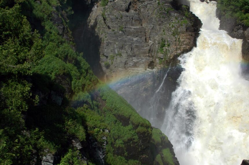
Thirty minutes from downtown the landscape changes completely. Parc de la Jacques-Cartier, north of the city on the 175 toward Saguenay, offers the closest and most dramatic canyon hiking in the region. The Rivière-à-l’Épaule trail climbs about four hundred metres in three kilometres to a viewpoint over the Jacques-Cartier valley, and returns on the same path for a roughly six-kilometre day. Les Loups, another trail in the same park, covers about eleven kilometres in a figure-eight that includes two ridgeline sections with strong views. The park has a visitor centre at the main entrance, day-use fees, and well-marked trails at every level from easy to difficult.
Mont-Sainte-Anne offers a different kind of close-in hiking. The summit is accessible by gondola for those who want the view without the climb, but the walking routes from the base to the summit are well built, about eight kilometres one way with eight hundred metres of elevation gain. The Sentier des Rocailles and the Sentier du Mont-Ste-Anne are the two main options, differing mostly in grade and forest type. Both cross onto the upper ski runs near the top, which gives the hiker unusual access to terrain usually seen only in winter.
Tier three: the Laurentian day trips
An hour or so further afield, the deeper Laurentians open up. Vallée Bras-du-Nord in Saint-Raymond has hiking trails on the same network as its mountain-biking routes, with the Shannahan trail being the most popular single objective. The trail covers about nine kilometres in a steady climb from the valley floor to a ridge with views over the Bras-du-Nord river and the surrounding mountains, returning on the same route for a six-hour day. Accommodation in eco-cabins along the river makes a two-day visit easy for anyone wanting to cover more than one trail.
Further north, the Sentiers Inter-Centre in the Saint-Raymond area connect several small summits in multi-hour loops. The Montagne Noire, the Montagne Grande-Coulée, and the Sentier Mestachibo between Saint-Raymond and Lac-Saint-Joseph each offer four to eight hours of walking for a moderately fit hiker. These are less crowded than the Parc de la Jacques-Cartier trails and provide a sense of the deeper boreal forest that visitors to the city rarely encounter.
What to bring
Summer conditions in the Quebec Laurentians are, on the whole, friendlier than most Canadians from warmer provinces expect. Temperatures between late June and early September generally run 18 to 26 Celsius, cooling to 12 to 15 at night in the mountains. Precipitation is moderate, with enough wet days that a rain shell is worth carrying on any trail longer than two hours. Insects are the main hazard. Black flies peak in late May and early June. Mosquitoes persist through July, particularly in wet areas. Insect repellent with DEET is effective and widely available in Quebec City pharmacies. Longer trails in Parc de la Jacques-Cartier or further north require the usual backcountry kit of water, food, first aid and a paper map, since cell coverage is unreliable in the deeper valleys.
Seasonality and trail conditions
The hiking season in the Laurentians runs from roughly late May, once the snow has cleared from the trails, to mid-October, when the first significant snowfall usually closes the higher routes. Early June can be wet and muddy. Late June through mid-September is the reliable window. Early October, during the two or three weeks of peak autumn colour, is the single best time of year on most trails, with dry conditions, cool temperatures, and views that justify the planning. The urban walks inside the city are usable year-round, though winter hiking on the Plains and at Maizerets shifts toward snowshoeing and cross-country skiing.