The Parc linéaire de la rivière Saint-Charles — the 32-kilometre multi-use trail following the Saint-Charles River from the Wendake reserve in the north to the Old Port in the south, through the urban core of the La Cité-Limoilou arrondissement — is Quebec City’s finest urban linear park and the infrastructure project that has most completely transformed the relationship between the city’s northern residential communities and the river that flows through them. The trail’s completion (a process that unfolded over 25+ years of progressive sections from the 1980s through the 2010s) produced a continuous greenway connecting the Lac Saint-Charles watershed in the north to the St. Lawrence waterfront in the south — a north-south active transportation and recreation axis that the city’s predominantly east-west arterial road system had previously denied.
The Route from Wendake to the Old Port
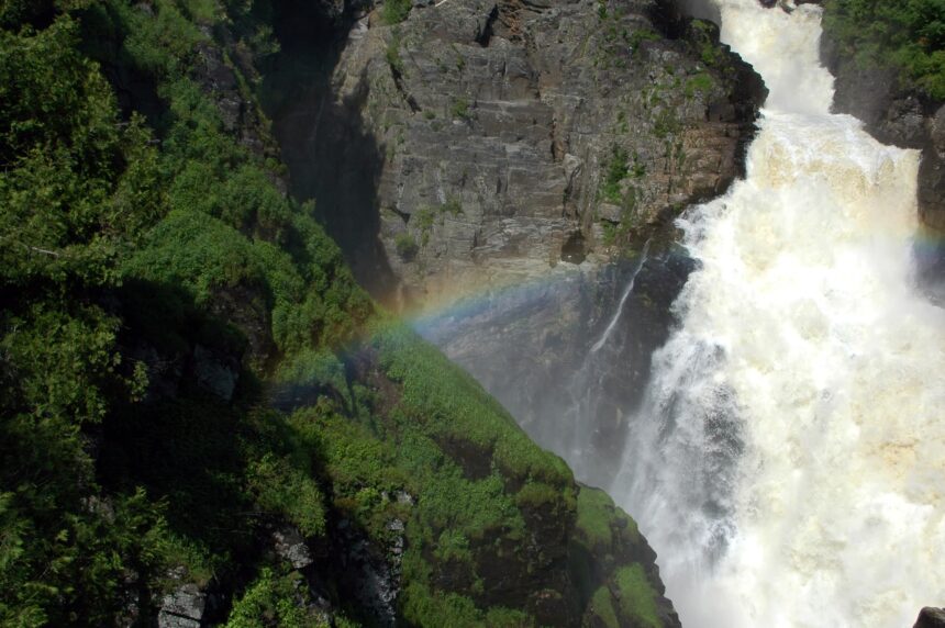
The trail’s northern terminus at the Wendake reserve (accessible from the Village Huron-Wendat) passes through the Chute Kabir Kouba (the spectacular 28-metre waterfall in the Saint-Charles gorge within the Wendake territory), through the Lac Saint-Charles watershed’s restored riparian corridor, through the Charlesbourg residential communities, past the Domaine Maizerets heritage park in Lairet, through the Vieux-Limoilou and Lairet urban sections, and concludes at the Old Port’s waterfront promenade where the Saint-Charles River empties into the St. Lawrence. The full 32-kilometre route requires 3-4 hours by bicycle at a moderate pace or 6-8 hours on foot; most users access sections of the trail rather than completing the full route in a single excursion.
The Saint-Charles River Restoration
The creation of the linear park trail was accompanied by the most extensive river restoration program in Quebec City’s history: the progressive removal of industrial and residential development from the riverbanks (some properties were expropriated, others negotiated), the re-establishment of native riparian vegetation (cattail marshes, willow and alder floodplain forest, and the native shrub communities that had been replaced by concrete and riprap), and the water quality improvement programs that have dramatically reduced the bacterial contamination of the Saint-Charles’s flow since the 1990s. The restoration’s results are visible throughout the trail’s urban sections: the wildlife that has returned to a restored urban river corridor (great blue herons nesting in the Domaine Maizerets, beaver activity throughout the northern sections, the osprey and kingfisher that use the restored river sections for fishing) documents the ecological transformation that the restoration program has achieved.
Year-Round Use
The Parc linéaire de la rivière Saint-Charles is actively used in all four seasons — the trail surface (paved in the urban sections, packed gravel in the more natural sections) supports cycling from April through October and snowshoeing, cross-country skiing, and winter walking from December through March. The winter trail condition varies by section: the urban Limoilou sections are maintained for winter pedestrian use; the more natural Charlesbourg and Lac-Saint-Charles sections are not groomed for skiing but support snowshoe use on the packed snow of winter pedestrian traffic. The trail’s most rewarding seasonal moments: the spring flood conditions (late March-early April, when the Saint-Charles’s snowmelt flow transforms the river from its winter trickle to a rushing spring torrent that fills the floodplain), the summer wildflower bloom in the restored wetland sections, and the autumn migration period (September-October, when the riparian corridor attracts migrating warblers and waterfowl in concentrations visible nowhere else within the urban core).